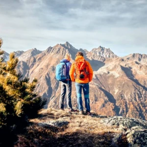
Bike and Hike in Paznaun - that is the perfect combination for incomparable outdoor adventures in XXL. Because around Galtür, Ischgl, Kappl and See the two activities can be wonderfully combined. So you can explore the most action-packed trails by mountain bike and at the same time conquer the most breathtaking peaks on foot. Paznaun is considered both a mountain bike El Dorado and a unique hiker's paradise - there's something for everyone. So get going and experience unforgettable moments in the breathtaking landscape of Paznaun!
The Bike & Hike experience in Paznaun is just the thing for those who want to put together their own sporting nature experience. First, you can fight your way up spectacular trails meter by meter on a mountain bike and then relax in summit bliss. Or you can choose the e-bike option to save your energy for the later hiking stage.
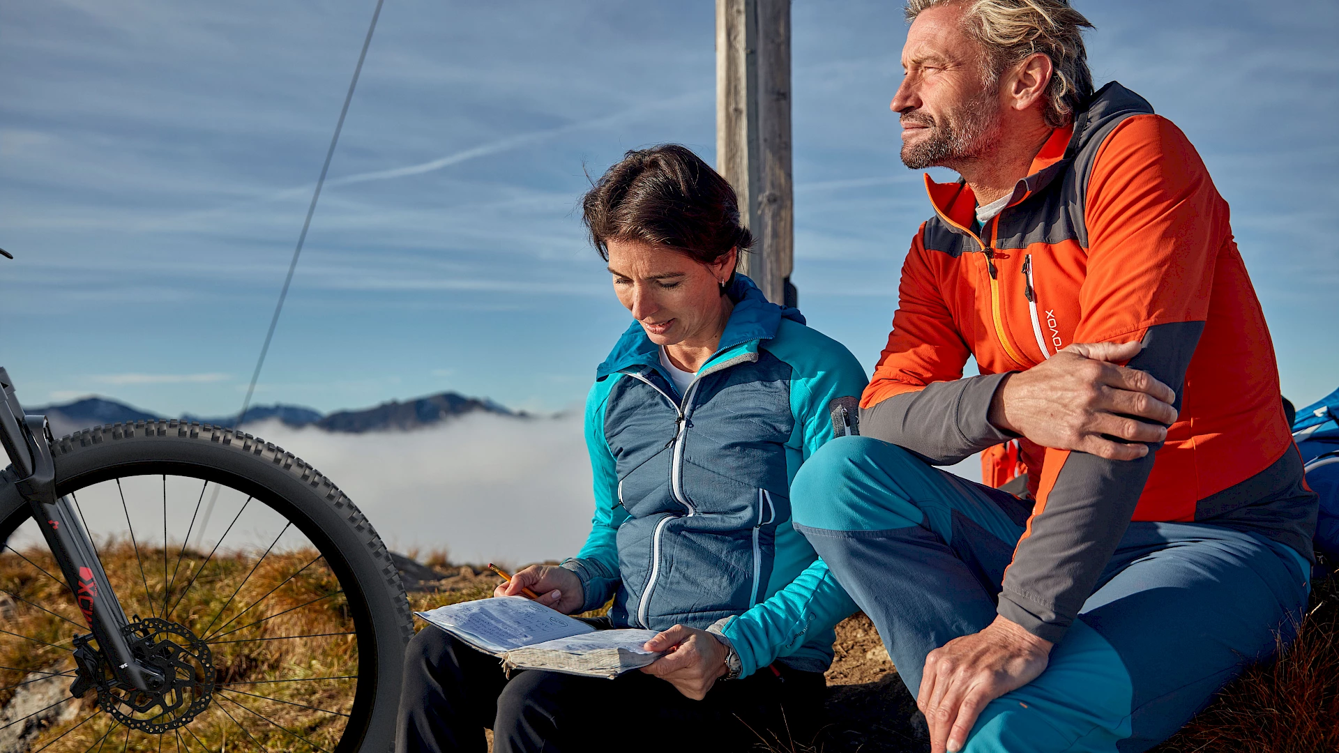
Cycling is fun - especially when you don't have to worry about where to park your bike. Because at the end of the trail, a modern bike depot awaits in any case, where the bikes can be safely stowed. So you can concentrate fully on the tour and enjoy the scenery.
The advantage of this is that the way there and back to the starting point of the chosen hiking route falls into the category of "fast and uncomplicated". In addition, the bike is well and safely parked while you explore the Tyrolean mountains on foot.
KontaktinformationenInformation:
Mehr Infos unter:
As soon as the bike is stowed away in the practical depot, the hiking boots come into play. Because in the mountains around Galtür, Ischgl, Kappl and See some of the most beautiful hiking trails in the Alps await. From short and crisp to long and leisurely: What do all the routes in Paznaun have in common? The fantastic views of the surrounding nature along the way.
Tip: Hiking is a great sport and the view of fantastic landscapes always motivates us anew. But it's not uncommon for us to feel hungry and thirsty after just a short time. Fortunately, there are numerous cozy huts in the mountains of Tyrol where you can fortify yourself. Kaiserschmarren definitely taste best when enjoyed with a magnificent view of the surrounding landscape!
Kappl – Visnitzalpe – Mittagskopf
mittel | 8,2 km | 1080 hm
Kappl – Seßladalpe – Niederelbehütte – Kappler Kopf
mittel | 21,6 km | 1143 hm
Kappl – Seßladalpe – Niederelbehütte – Kreuzjochspitze
schwierig | 22,9 km | 1630 hm
Kappl – Seßladalpe – Niederelbehütte – Seßladspitze
schwierig | 24,0 km | 1483 hm
Kappl – Almstüberl – Alblittköpfe (über Diastrail zurück ins Tal)
schwierig | 26,8 km | 1620 hm (Nutzung der Bergbahnen möglich)
Ischgl – Larein Alpe – Berglisee
leicht | 12,6 km | 821 hm
Ischgl/Piel – Friedrichshafner Hütte – Hohe Köpfe
mittel | 19,2 km | 1257 hm
Ischgl/Piel – Friedrichshafner Hütte – Grießkogel
schwierig | 15,3 km | 1210 hm
Ischgl – Bergstation Velillbahn – Bürkelkopf (über Velilltrail zurück ins Tal)
schwierig | 18,1 km | 1570 hm (Nutzung der Bergbahnen möglich)
Ischgl – Bergstation Flimjochbahn – Bürkelkopf
schwierig | 20,2 km | 1570 hm (Nutzung der Bergbahnen möglich)
Ischgl – Heidelberger Hütte – "Die drei 3.000er": Bischofsspitze, Breite Krone, Grenzeckkopf
schwierig | 21,2 km | 1835 hm
Ischgl – Viderjoch (Bergstation Flimjochbahn) – Schmuggler Trail – Alp Trida Sattel (CH) – Piz Munschuns (CH)
schwierig | 31,0 km | 2220 hm (Nutzung der Bergbahnen möglich)
Ischgl – Viderjoch (Bergstation Flimjochbahn) – Alp Trida (CH) – Alp Bella (CH) – Grübelekopf
schwierig | 31,1 km | 2420 hm (Nutzung der Bergbahnen möglich)
See – Medrigalm – Ascherhütte – Rotpleiskopf
schwierig | 29,3 km | 1884 hm (Nutzung der Bergbahnen möglich)
See – Medrigalm – Ascherhütte – Furgler
schwierig | 32,0 km | 2166 hm (Nutzung der Bergbahnen möglich)
Galtür – Alpengasthof Zeinis – Verbellaalpe – Wiegensee
leicht | 12,2 km | 528 hm
Galtür – Alpengasthof Zeinis – Breitspitze
leicht | 13,7 km | 752 hm
Galtür – Alpengasthof Zeinis – Fädnerspitze
mittel | 9,0 km | 1178 hm
Galtür – Larein Alpe – Predigberg
mittel | 13,3 km | 1173 hm
Galtür – Alpengasthof Zeinis – Verbellaalpe – Versalspitze
mittel | 14,9 km | 1047 hm
Galtür – Berggasthof Piz Buin – Bielerspitze
mittel | 16,2 km | 1050 hm
Galtür – Jamtalhütte – westliches Gamshorn
schwierig | 12,0 km | 1398 hm
Galtür – Jamtalhütte – "Die drei 3.000er": Bischofsspitze, Breite Krone, Grenzeckkopf
schwierig | 17,2 km | 1578 hm
Galtür – Kops Stausee – Heilbronner Hütte – Muttenjoch – Gaisspitz
schwierig | 18,7 km | 1401 hm
Galtür – Berggasthof Piz Buin – Hohes Rad
schwierig | 30,70 km | 1591 hm